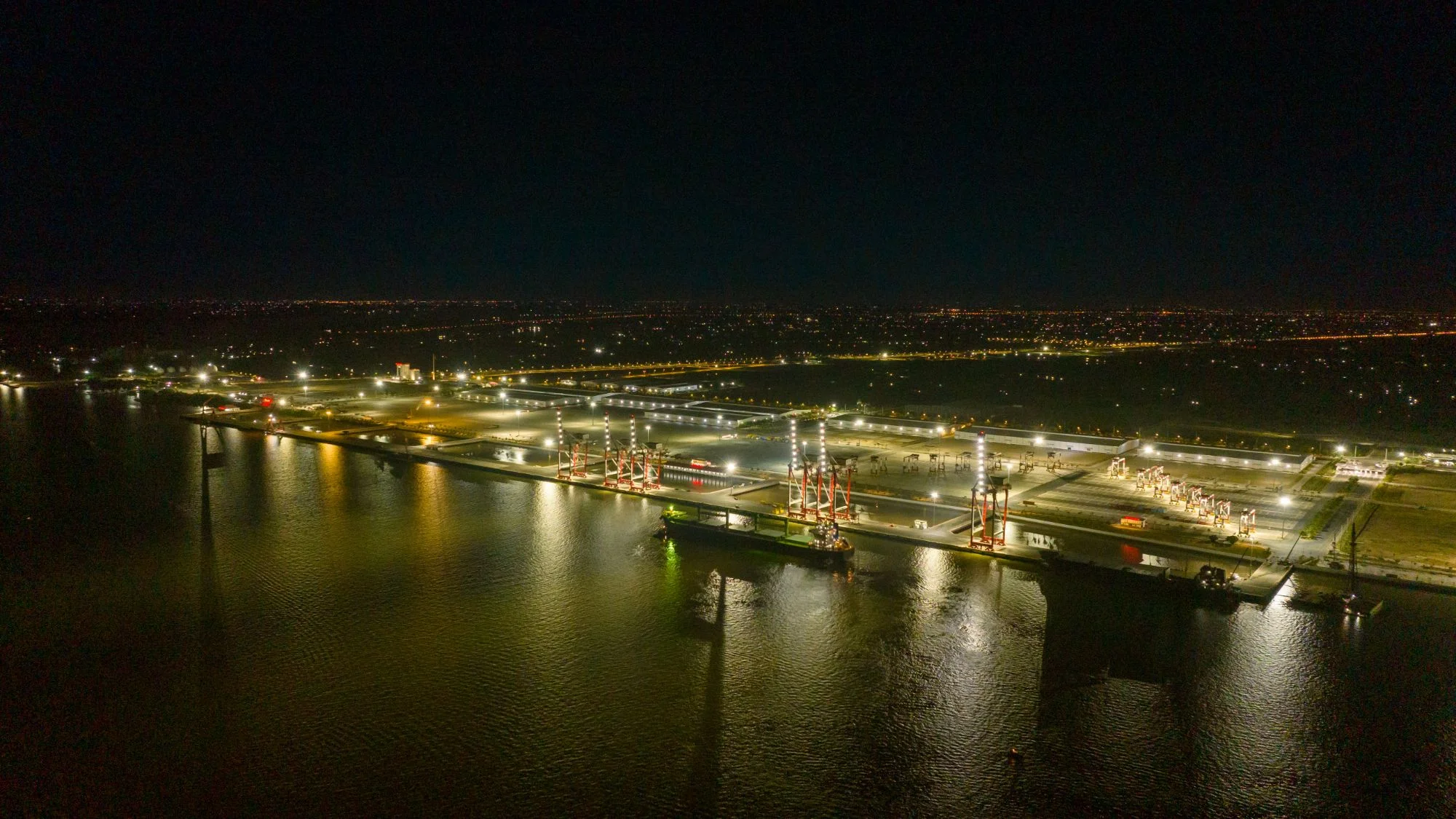
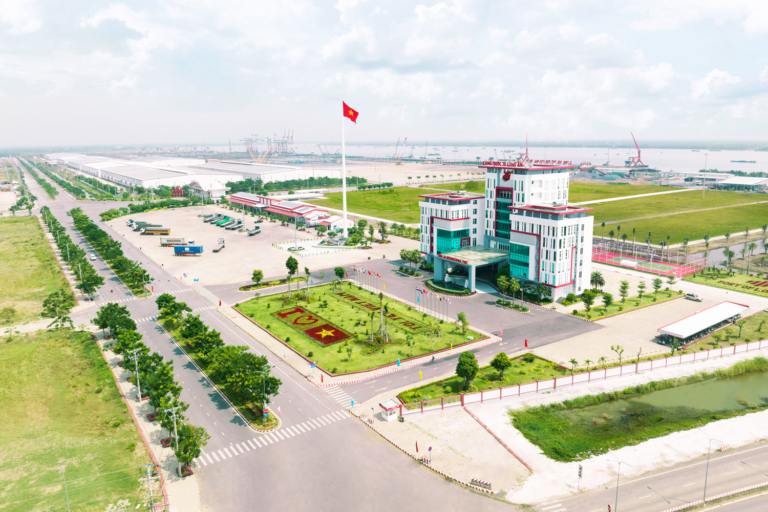
The port’s strategic location places it in a prime position to play a pivotal role in Dongtam Group’s master plan, which aims to make a substantial contribution to the developmental objectives of the province, region, and nation. The future of the area is on the rise, with plans in place to create a comprehensive industrial ecosystem that will include the port, an industrial park, an industrial service zone, and an urban area.
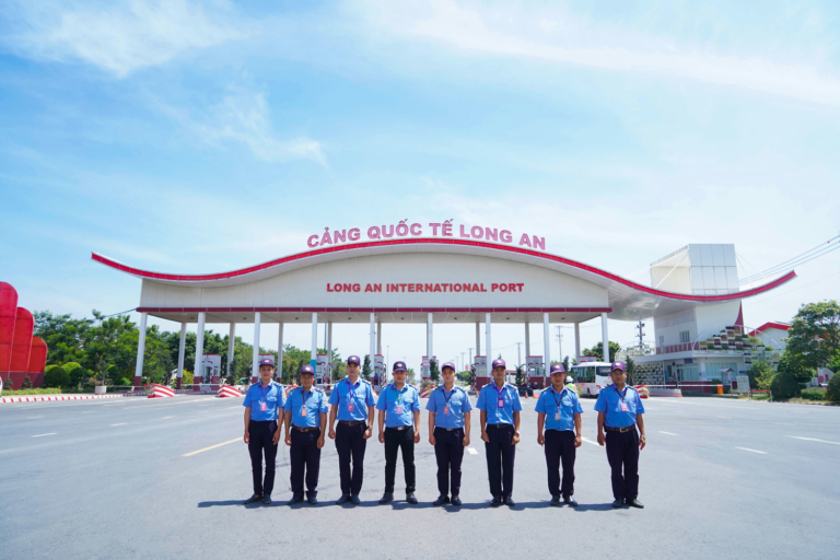
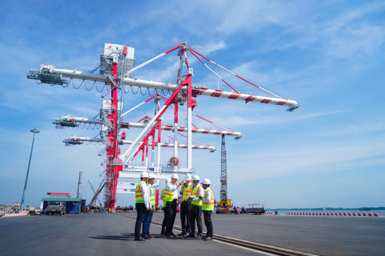
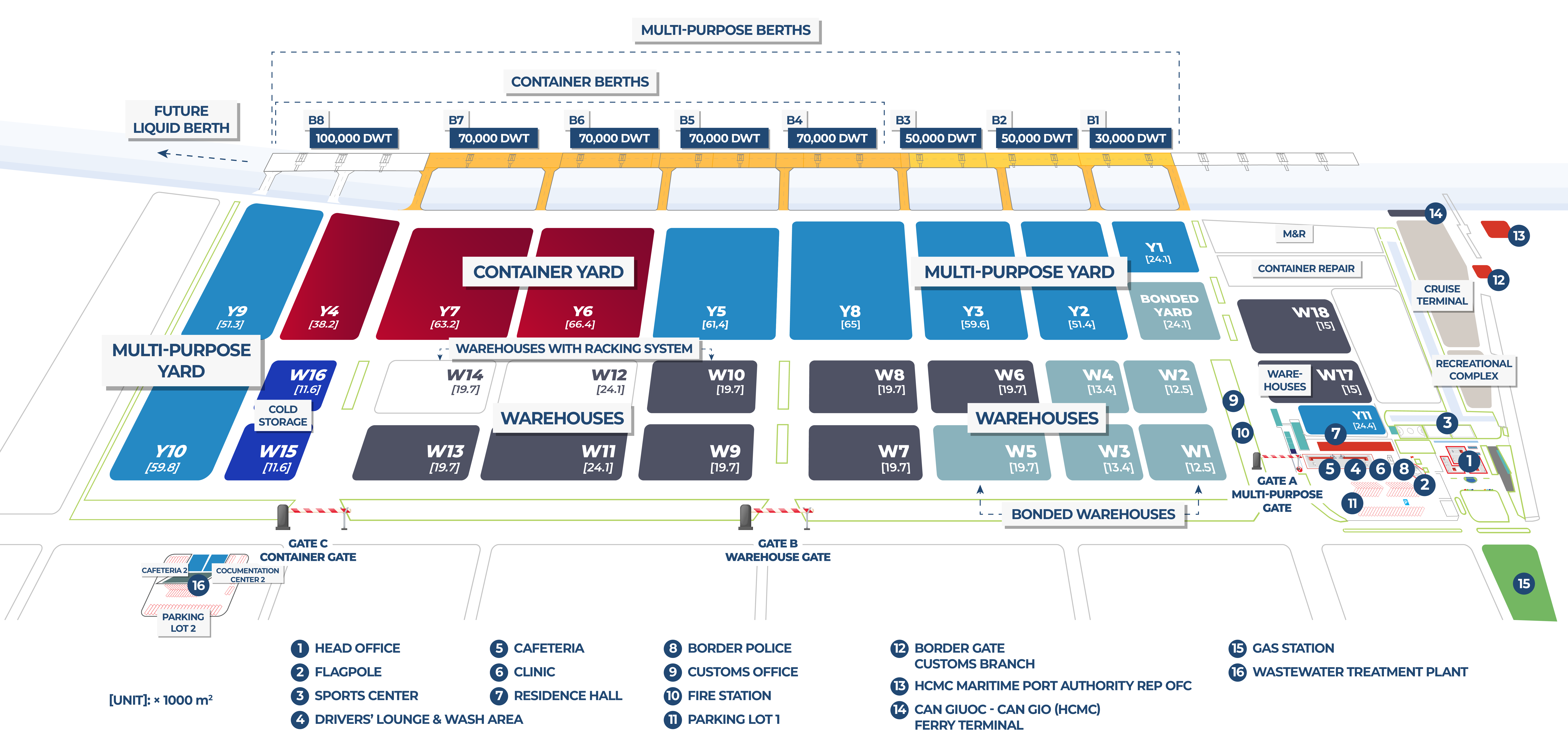
This ecosystem will create a central hub for seamless trade flow between Tay Ninh Province, the Mekong Delta Region, and the rest of the world. Long An International Port is designed to provide 3.000.000 TEU world-class, full-service container handling capacity in 2023. When fully completed, the port will have a total of 9 berths having a continuous length of 2,368m and capable of receiving vessels up to 100,000 DWT.
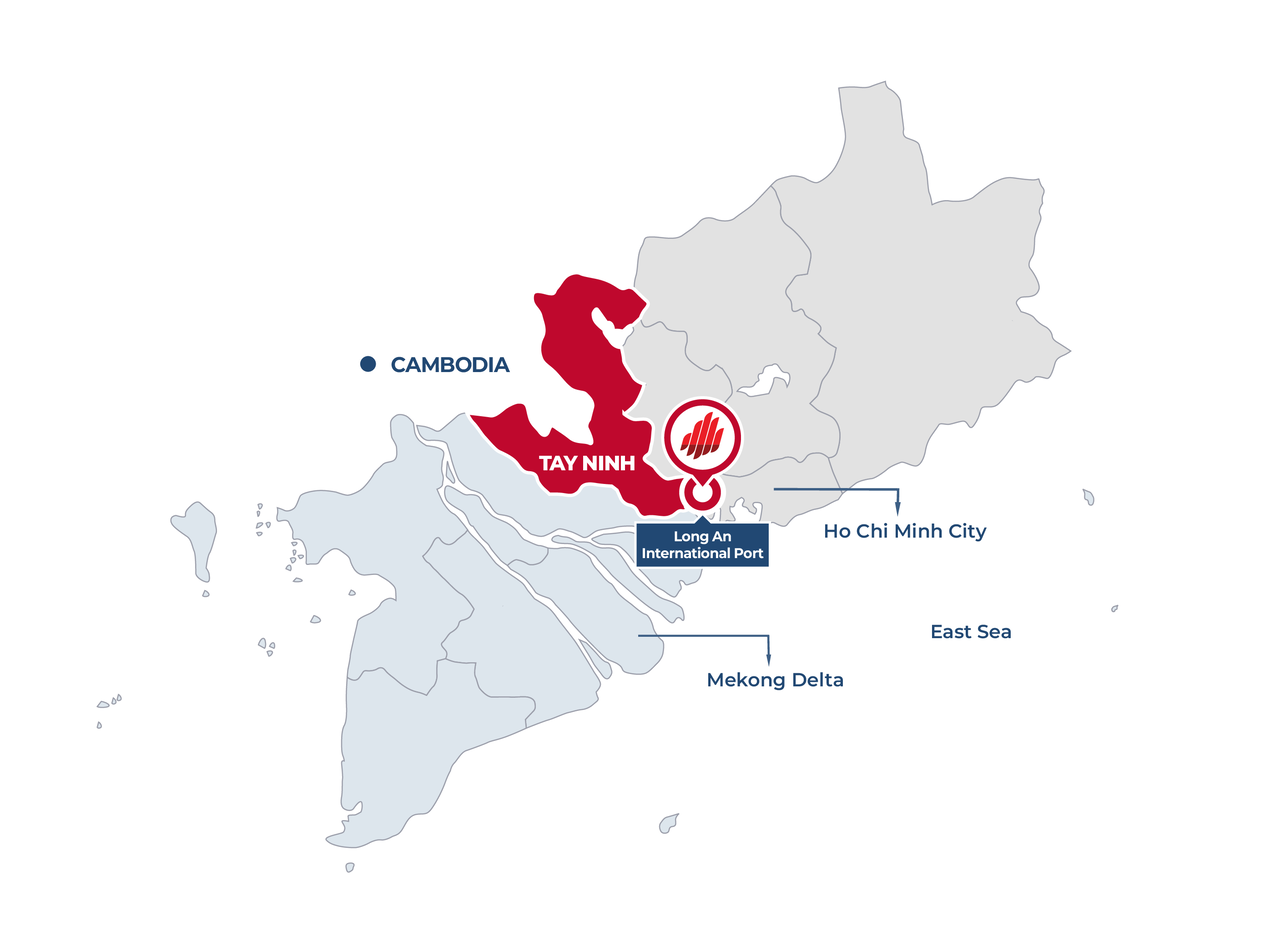
Port Location in Tay Ninh Province
Long An International Port is strategically located in Tay Ninh Province which is the closest link between Ho Chi Minh City, 6 provinces to the south, Cambodia to the west, and the East Sea. This means cargo owners, shippers, and shipping lines alike can benefit from the resulting low overall transportation cost.
Located just 38km away from Ho Chi Minh City via National Route 50, the port is easily accessible and also benefits from its proximity to the pilot station, which is only 21 nautical miles away.
Additionally, there are 22 industrial parks within Tay Ninh Province, as well as 12 other nearby provinces to the south, making the port an ideal choice for businesses looking to reduce maritime costs and lower overall transportation expenses in and out of the Mekong Delta Region.
By providing an alternative option to HCMC’s port system, Long An International Port can also help alleviate congestion and lower logistics costs for customers in the Mekong Delta.
Tay Ninh Province is quickly realizing its massive potential to drive continued growth and development in the Mekong Delta Region.
- Strong economic growth
- Growing presence of global brands
- Active investments by the local and national government

Need a quotation for your port and logistics needs?
Whether it’s for a one-off shipment or a long-term requirement, we are here to help optimize your supply chain.
Getting to Long An International Port
To reach the seaport, there are two primary transportation options: by road or by waterway. If traveling by road, logistics providers can access the port via the highway network that connects the region to major cities and trade routes. Alternatively, cargo owners can opt for waterway transportation, leveraging the extensive network of rivers and canals that link the port to other key inland locations. These options offer a seamless and efficient way for shipping goods to and from the seaport, making it an ideal hub for logistics and supply chain activities.
| CHANNEL | Soai Rap |
| Distance from Buoy No.0 to LAIP | 21 nautical miles |
| Check-in point for return of pilot | 10°20’00 N – 107°03’00 E |
| Channel Depth (at Zero Tide) | Current: -9,0m Future: -11.5m |
| Airdraft Restriction at Channel | No restriction from Buoy No.0 |
| Port’s Location | 10°32’12 N – 106°44’20 E |
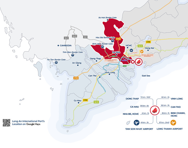
Long An International Port has many routes connecting to the provinces in the Mekong Delta and HCMC such as: DT830, National Route 50, Ben Luc – Long Thanh Highway, future belt roads,…
Distance from Long An International Port (LAIP) to the Mekong Delta provinces:
- LAIP – Dong Thap: 72km
- LAIP – Vinh Long: 82km
- LAIP – Can Tho: 165km
- LAIP – Ca Mau: 310km
- LAIP – Nha Be, HCMC: 41km
- LAIP – Binh Chanh, HCMC: 36km
- LAIP – Tan Son Nhat Airport: 49km
- LAIP – Long Thanh Airport: 97km
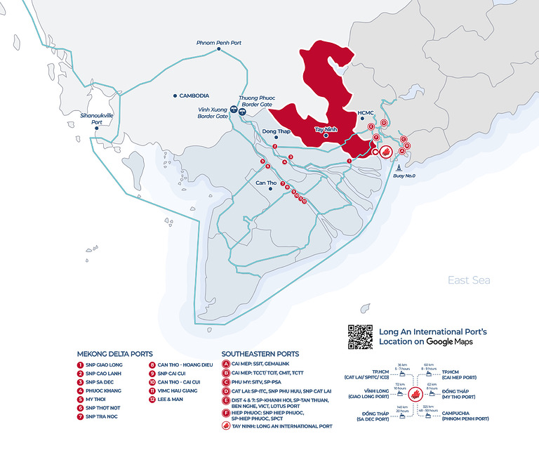
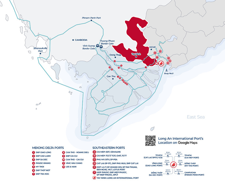
Long An International Port can connect easily to the Mekong Delta through Vam Co river. Besides that, Long An International Port can also connect with ports and ICDs in HCMC through Soai Rap river.
Distance from Long An International Port (LAIP) to ports and ICDs in Ho Chi Minh City:
- LAIP – Cat Lai/ SPITC/ ICD: 36km
- LAIP – Giao Long Port: 72km
- LAIP – Sa Dec Port: 140km
- LAIP – Cai Mep Port: 60km
- LAIP – My Tho Port: 62km
- LAIP – Phnom Penh Port: 325km
You may also like…
